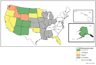
This very basic map shows how each state in the United States is currently employing the business plans for using cadastral information. By color, the states are shaded in order to easily show the reader the status of each state. The theme of this specific map is the status of the states using information.

No comments:
Post a Comment